Related Articles
Geography of Sri Lanka
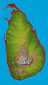
Topographic map of Sri Lanka
The island of Sri Lanka lies atop the Indian tectonic plate, a minor plate within the Indo-Australian Plate. It is positioned in the Indian Ocean, to the southwest of the Bay of Bengal, between latitudes 5° and 10°N, and longitudes 79° and 82°E. Sri Lanka is separated from the Indian subcontinent by theGulf of Mannar and the Palk Strait. According to the Hindu mythology, a land bridge existed between the Indian mainland and Sri Lanka. It now amounts to only a chain of limestone shoals remaining above sea level. It was reportedly passable on foot up to 1480 AD, until cyclones deepened the channel.
The island consists mostly of flat-to-rolling coastal plains, with mountains rising only in the south-central part. Amongst these is the highest point Pidurutalagala, reaching 2,524 metres (8,281 ft) above sea level. The climate of Sri Lanka can be described as tropical and warm. Its position endows the country with a warm climate moderated by ocean winds and considerable moisture. The mean temperature ranges from about 17 °C (62.6 °F) in the central highlands, where frost may occur for several days in the winter, to a maximum of approximately 33 °C (91.4 °F) in other low-altitude areas. The average yearly temperature ranges from 28 °C (82.4 °F) to nearly 31 °C (87.8 °F). Day and night temperatures may vary by 14 °C (57.2 °F) to 18 °C (64.4 °F).
Rainfall pattern of the country is influenced by Monsoon winds from the Indian Ocean and Bay of Bengal. The "wet zone" and some of the windward slopes of the central highlands receive up to 2,500 millimetres (98.4 in) of rain each month, but the leeward slopes in the east and northeast receive little rain. Most of the east, southeast, and northern parts of the country comprise the "dry zone", which receives between 1,200 mm (47 in) and 1,900 mm (75 in) of rain annually. The arid northwest and southeast coasts receive the least amount of rain at 800 mm (31 in) to 1,200 mm (47 in) per year. Periodic squalls occur and sometimes tropical cyclones bring overcast skies and rains to the southwest, northeast, and eastern parts of the island. Humidity is typically higher in the southwest and mountainous areas and depends on the seasonal patterns of rainfall.
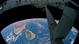
Sri Lanka seen from space
The longest of the 103 rivers in the country is Mahaweli River, covering a distance of 335 kilometres (208 mi). These waterways give rise to 51 natural waterfalls, having a height of 10 meters or more. The highest one is Bambarakanda Falls, with a height of 263 metres (863 ft). Sri Lanka's coastline is 1,585 km long. It claims to an Exclusive Economic Zone (EEZ) extending 200 nautical miles. This is approximately 6.7 times the country's land area. The coastline and adjacent waters support highly productive marine ecosystems such as fringing coral reefs, shallow beds of coastal and estuarine seagrasses. Sri Lanka inherits 45 estuaries and 40 lagoons too. Country's mangrove ecosystem which spans over 7,000hectares, played a vital role in buffering the force in the waves of 2004 Indian Ocean tsunami. The island is rich with minerals such as Ilmenite, Feldspar, Graphite, Silica, Kaolin, Mica and Thorium. Existence of Petroleum in the Gulf of Mannar has also been confirmed and extraction attempts are underway.
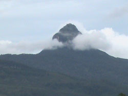
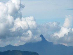
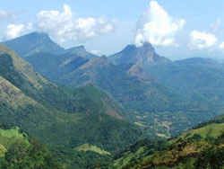
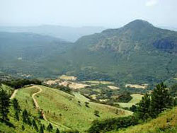
Highest Mountains in Sri LankaIn the central and southern parts of Sri Lanka there are several Mountains and Peaks that are highly ecological and rich in bio diversity. These mountains are preserved as forests and are the starting points of many rivers. The Sri Pada mountain is Sri Lanka's holy peak where people make pilgrims to worship foot print of lord Buddha.
|
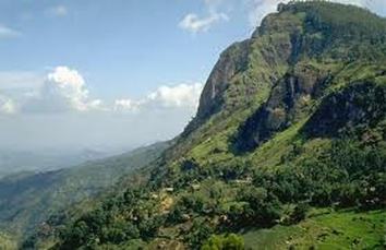
Pidurutalagala Mt. Highest mountain in Sri Lanka
Pidurutalagala MountainSri Lanka's highest peak, also known as Mount Pedro, rises 2524m (8281ft) above sea level, immediately behind the town. Unfortunately, the path to the summit, which is the site of Sri lanka's main television transmitter, is closed to visitors for security reasons. For a view of the summit and a superb panorama of the surrounding hills and plantations, you can walk to the top of the picturesquely named single Tree Mountain, south of town off the Badulla road, in about 90 minutes.
|
Image Gallery
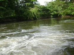
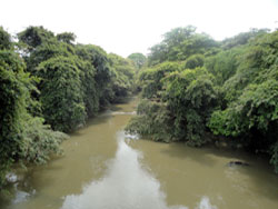
Rivers
The rivers of Sri Lanka originate in the central highlands. From there they descend to the plains and empty into the sea. The rivers are typically unnavigable in their higher reaches, where they flow swiftly and turbulently through highly eroded passages to the plains below. Many rivers descend over steep cliffs, forming spectacular waterfalls. In their lower courses, the rivers slowly meander through flood plains and deltas.
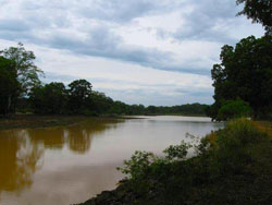
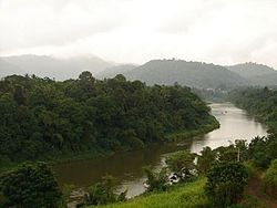
The longest river of Sri Lanka, the Mahaweli, traverses a course of about 330 km (about 205 mi). It flows northeastward across the central highlands and empties into the Bay of Bengal near the port of Trincomalee, on the eastern coast. The country?s second longest river is the Aravi Aru, traversing about 220 km (about 135 mi) on a northwestward course, from the central highlands to the Gulf of Mannār.
Sri Lanka has no natural lakes. Dams on the Mahaweli and other rivers have created large reservoirs. In addition, a series of small reservoirs called tanks dot the north central plains, storing water during the dry season. Some of the tanks were constructed as many as 2,000 years ago.
Longest Rivers in Sri Lanka
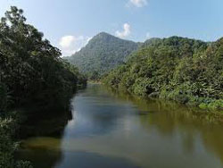    |
Mahaweli river, the longest river in Sri Lanka
Mahaweli RiverThe Mahaweli River, literally "Great Sandy River" is a 335 km (208 mi) long river, ranking as the longest river in Sri Lanka. Its drainage basin is the largest in the country, and covers almost one-fifth of the total area of the island. The river reaches the Bay of Bengal on the southwestern side of Trincomalee Bay. The bay includes the first of a number submarine canyons, making Trincomalee one of the finest deep-sea harbors in the world. The river and its tributaries are dammed at several locations to allow irrigation in the dry zone, with almost 1,000 km2 (386 sq mi) of land irrigated. Production of hydroelectricity from six dams of the Mahaweli system supplies more than 40% of Sri Lanka's electricity needs. One of the many sources of the river is the Kotmale Oya.
|
Waterfalls
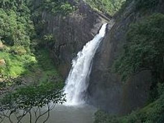
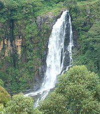
Dunhinda Falls is one of Sri Lanka's most beautiful waterfalls
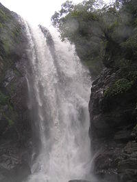
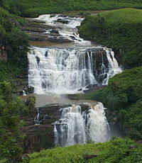
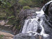
The island is blessed with 103 rivers and streams radiating from the central hills, rushing down rocky precipices forming a number of roaring waterfalls of Sri Lanka, various shapes and heights, all ending up loosing the momentum at the Indian Ocean.
More about Water falls & their details in Sri Lanka
More about Water falls & their details in Sri Lanka
List of Waterfalls in Sri Lanka
|
Aberdeen Falls,98 m (322 ft) ,Aberdeen, Central Province
Ahupini Ella, 10 m (33 ft) Central Province Alakola Falls, 60 m (197 ft) Baker's Falls, 20 m (66 ft) Horton Plains National Park, Central Province Bambarakanda Falls, 263 m (863 ft) Kalupahana Uva Province Bomburu Ella Perawella, Uva Bopath Ella Falls, 30 m (98 ft) Ratnapura, Sabaragamuwa Province Delta Falls, 60 m (197 ft) Dessford Falls, 20 m (66 ft) Devon Falls, 97 m (318 ft) Talawakele, Central Province Diyaluma Falls, 220 m (722 ft) Koslanda, Uva Province Doovili Ella ,40 m (131 ft) Central Province Dunhinda Falls, 63 m (207 ft) Badulla, Uva Province Elgin Falls, 25 m (82 ft) Ambewela, Central Province Galboda Ella, 30 m (98 ft)[3] Nawalapitiya, Central Province Galdola Falls, 100 m (328 ft) Garandi Ella, 100 m (328 ft) Balangoda, Central Province Gartmore Falls, 20 m (66 ft) Maskeliya Glain Falls, 10 m (33 ft) Central Province Handapan Ella, 200 m (656 ft) Handun Ella, 30 m (98 ft) Huluganga Falls, 75 m (246 ft) Huluganga Town, Central Province Hunnas Falls, 60 m (197 ft) Elkaduwa Central Kalupahana Falls, 10 m (33 ft) Kirindi Ella, 116 m (381 ft) Kothmale Mahakandura Falls, 10 m (33 ft) |
Kurunduoya Falls, 206 m (676 ft) Central Province
Laxapana Falls, 129 m (423 ft) Hatton, Central Province Lihinihela Ella, 200 m (656 ft) Lovers Leap, 30 m (98 ft) Nuwaraeliya, Central Province Madanagiri Falls, 70 m (230 ft) Mahakandura Falls, 120 m (394 ft) Manawela Falls ,22 m (72 ft) Mannakethi Ella, 60 m (197 ft) Mapanana Falls, 148 m (486 ft) Gilimale Nakkawita Falls, 100 m (328 ft) Nanuoya Falls, 60 m (197 ft) Central Province Okandagala Falls, 63 m (207 ft) Oolu Ella, 200 m (656 ft) Peessa Ella, Lunugala, Uva Province Puna Falls, 100 m (328 ft) Central Province Pundalu Oya Falls, 100 m (328 ft) Ramboda Falls, 109 m (358 ft) Pussellawa, Central Province Rathna Falls, 101 m (331 ft) Central Ravana Falls, 25 m (82 ft) ,Ella, Uva Province Rawan Ella, Uduhawara, Uva Province Sampath Ella, 30 m (98 ft) St. Clair's Falls, 80 m (262 ft) Hatton, Central Province Seetha Kotuwa, Falls 60 m (197 ft) Sri Pada Falls, 75 m (246 ft) Yaka Andu Ella, 60 m (197 ft) Windsor Forest Falls, 10 m (33 ft) |
Image Gallery